1 - Governing Documents
Below is a list of the Governing Documents for the community of Lagoon Point that are currently available online. Documents will be added as they are completed for viewing on the web.
All documents are in pdf format and require Adobe Acrobat Reader for viewing and printing. If you don't already have Acrobat Reader, you can download it free from the Adobe website.
2 - Plat Documents
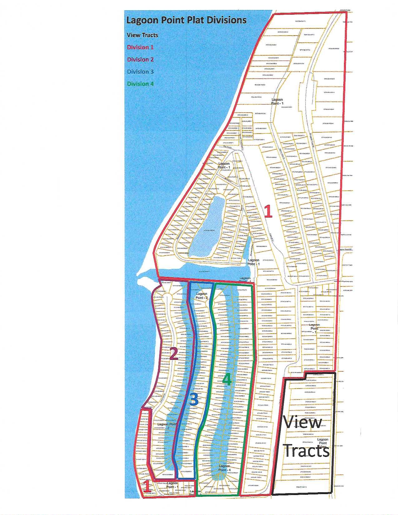
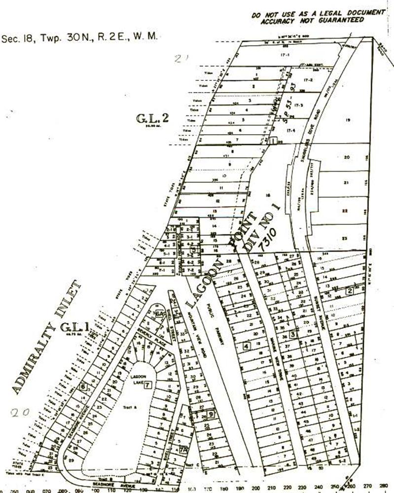
- Plat of Lagoon Point (1950)
- Replat of Lagoon Point View Tracts (1952)
- Replat of Lagoon Point No. 2 (1969)
- Replat of Lagoon Point No. 3 (1970)
- Replat of Lagoon Point No. 4 (1975)
- Covenants, Lagoon Point No. 2, 3 & 4 3 November 2009
3 - Court Rulings
4 - Dredging Maps, Harbor Entrance Map
- Pre-Dredging Map - 2013
- Post-Dredging Map - 2013
- Harbor Entrance Map - 2013
- Bathymetric Survey - 2017
- Jetty Channel Chart - 2017
5 - LPCA POLICIES:
Lot C Gate Card, Fishing and Parking Tag Policy: Lot C Gate Card, Fishing & Parking Tag Policy Rev 4A 09-18-2023
Special Use Policy, Application and Permit/Contract for use of LOT B and LOT C parking lots and launch ramp for PRIVATE DOCK or PILING projects: Lot C Special use Policy Original 1-10-20 rev.3
Rules For Use Of LPCA “COMMON PROPERTIES”: See the Activities/Fishing tab.
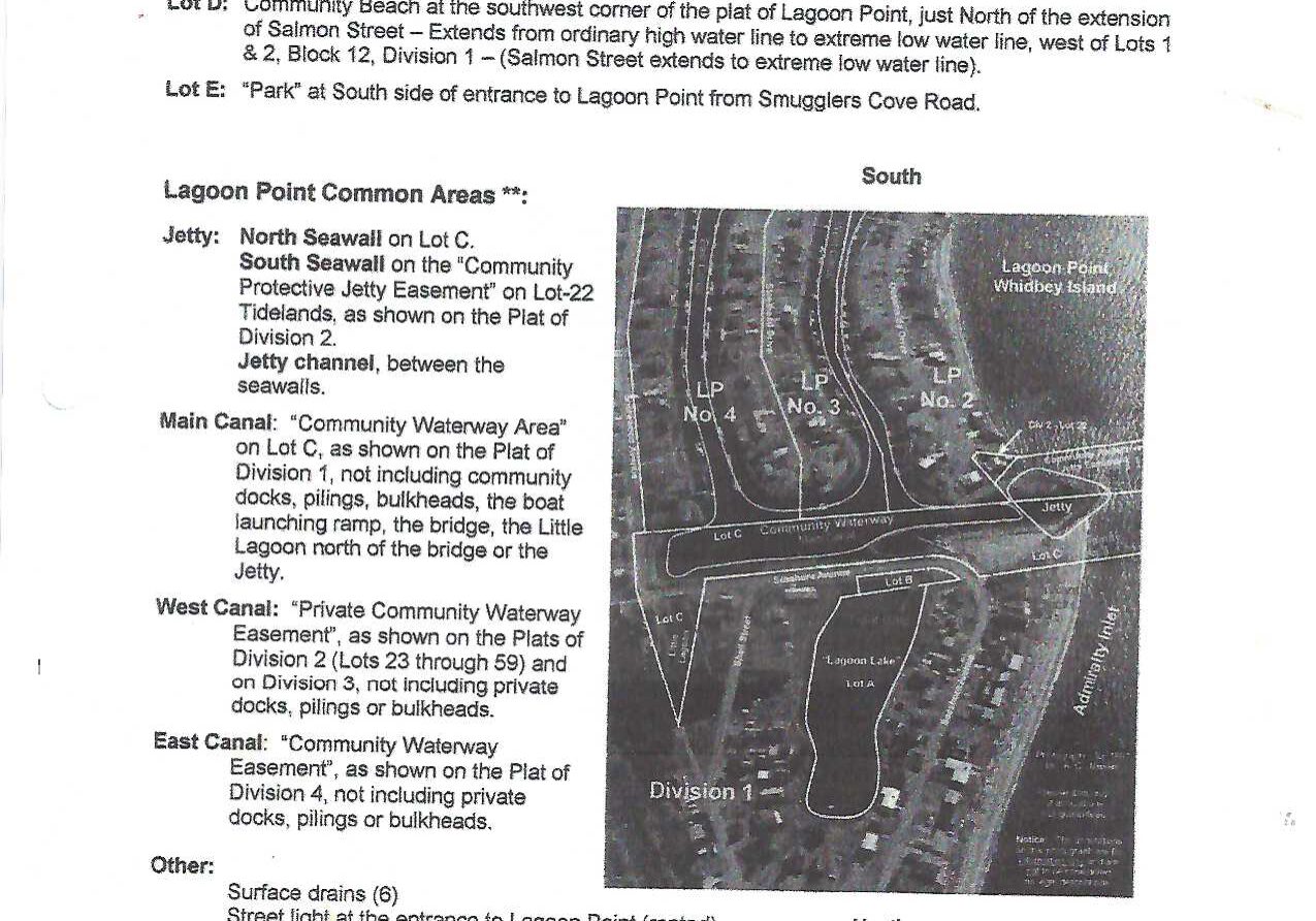
6 - Guide to "Common Properties" owned by LPCA Members and locations:
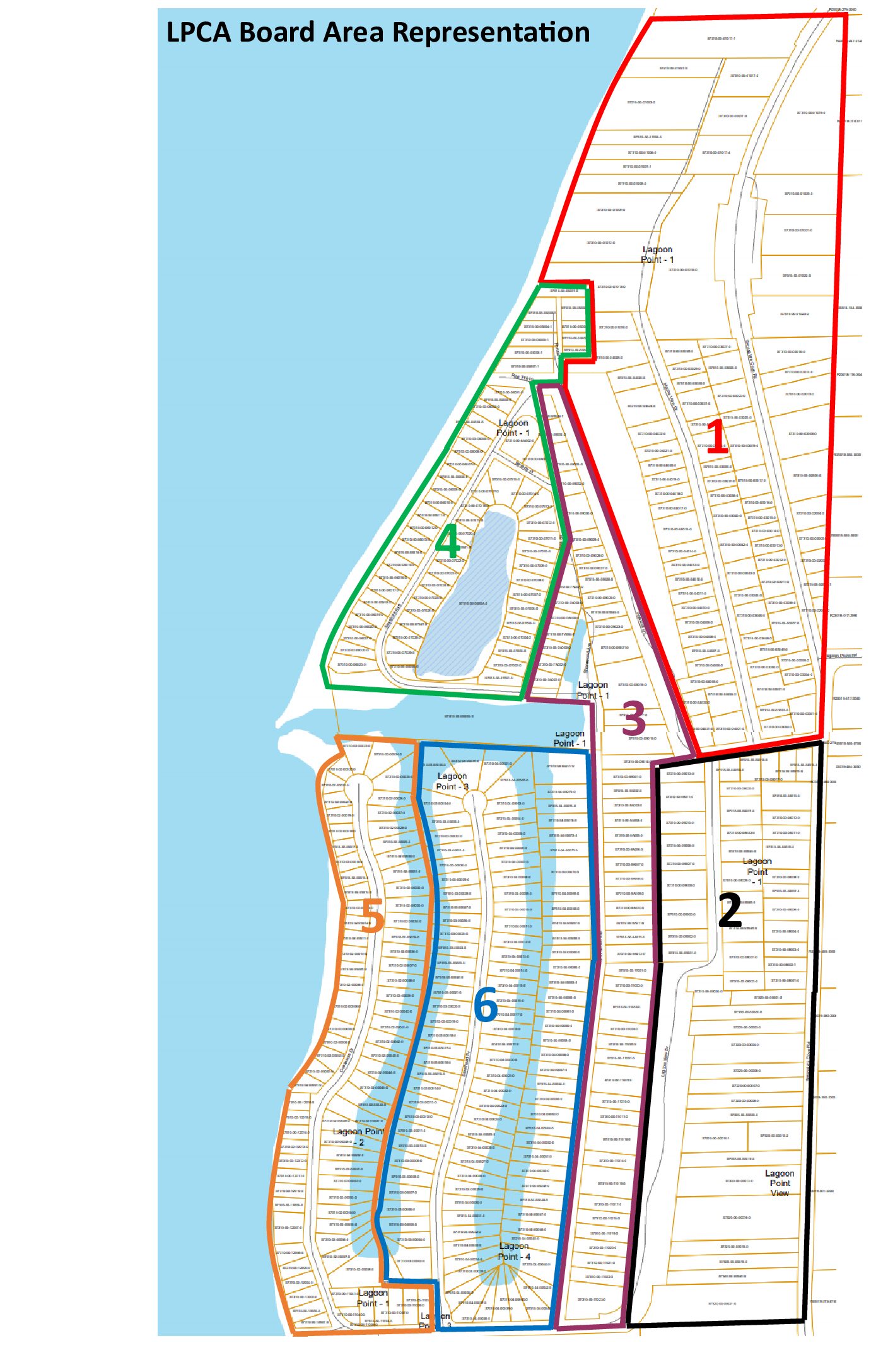
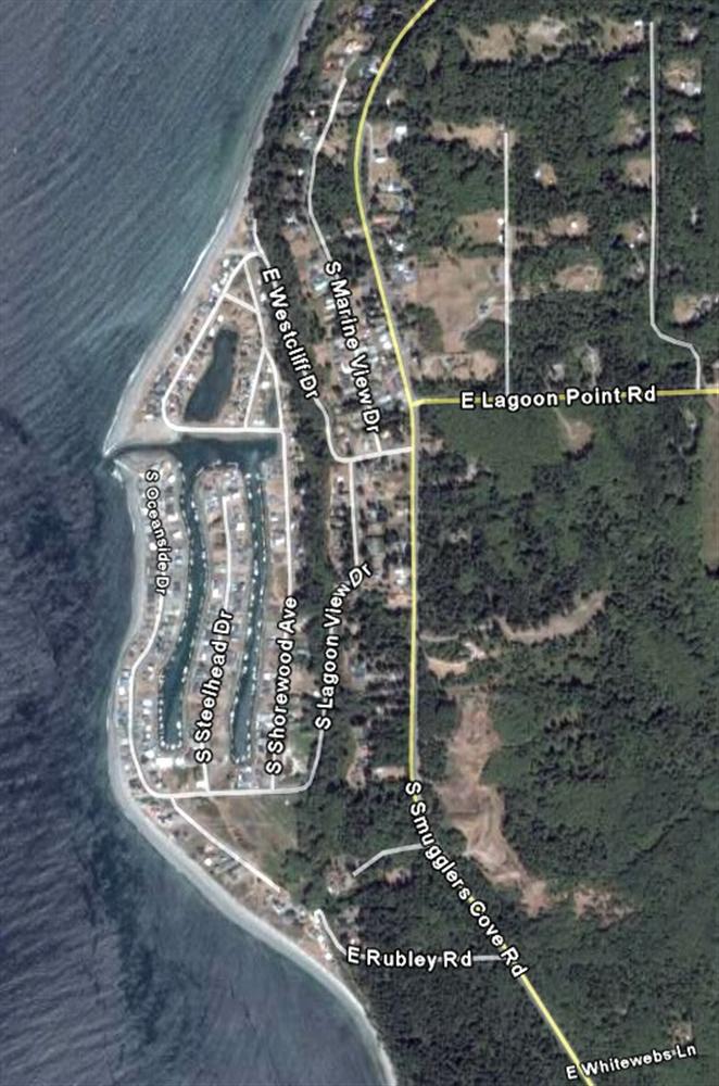
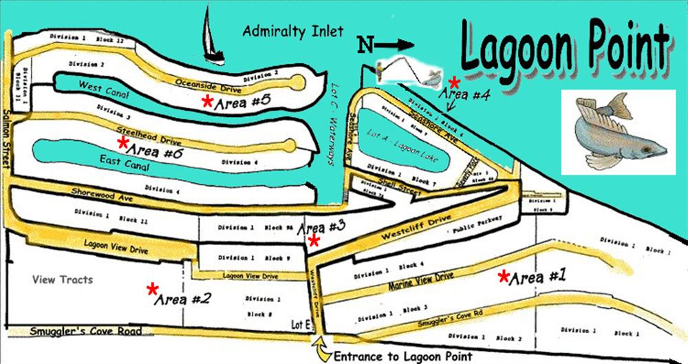
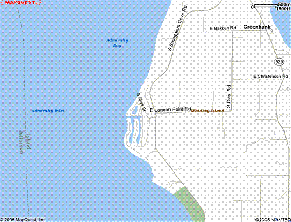
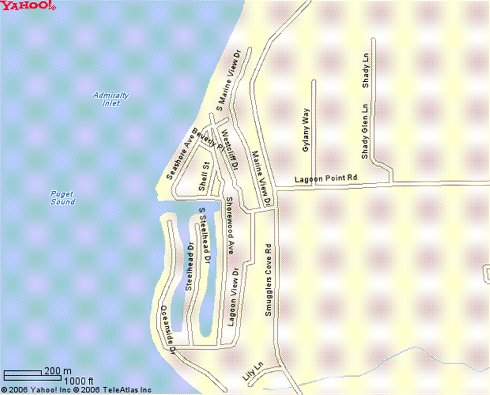
Lot A (1): Lagoon Lake, North of Seashore Avenue and West of Shell Street. Located in Division 1
Lot A (2): A small corner parcel on the West side of Steelhead Drive and Salmon Street. Located in Division 3
Lot B: Strip of land South of Lagoon Lake along Seashore Avenue and parking lot East of the boat launch gate on Southeast corner of Lagoon Lake. Located in Division 1
Lot C: Boat launch ramp parking lot. LPCA Members only access. LPCA fishing tags to be worn for access. Secured by LPCA electric gate pass. Also consists of the beach and jetty including the waterways from Jetty to bridge on East end of Seashore Avenue, to the North boundary of the two canals. Located in Division 1
Lot D: Community Beach tide flats in front of two homes (lot 1 & 2, block 12) , just north of Island County Parks property on the South end of Lagoon Point development. The lot is 93 feet wide. LCPA property is West of the corner of Salmon Street & Oceanside Drive. LPCA fishing tags to be worn for access. Located in Division 1
Lot D: See Island County Park map & LPCA South Beach Access pdf doc for details.
Lot E: Two lots (#15 & #16) on the corner of Smuggler’s Cove Road & Westcliff Drive. Location of our Lagoon Point sign. Located in Division 1.
Main Canal: Community Waterway Area on Lot C.
East Canal: Private property owned by lot owners with canal access on West side of Shorewood Drive and East side of Steelhead Drive. There is a Division 2, 3, 4 Community Waterway Easement. Located in Division 4
West Canal: Private property owned by lot owners with canal access on West side of Steelhead Drive and East side of Oceanside Drive. There is a Division 2, 3, 4 Community Waterway Easement. Located in Division 2 & 3.
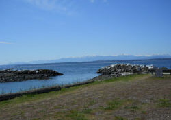
Background image credit: Hugh Shipman - Gravel Beach © 2019 Lagoon Point. All Rights Reserved.
